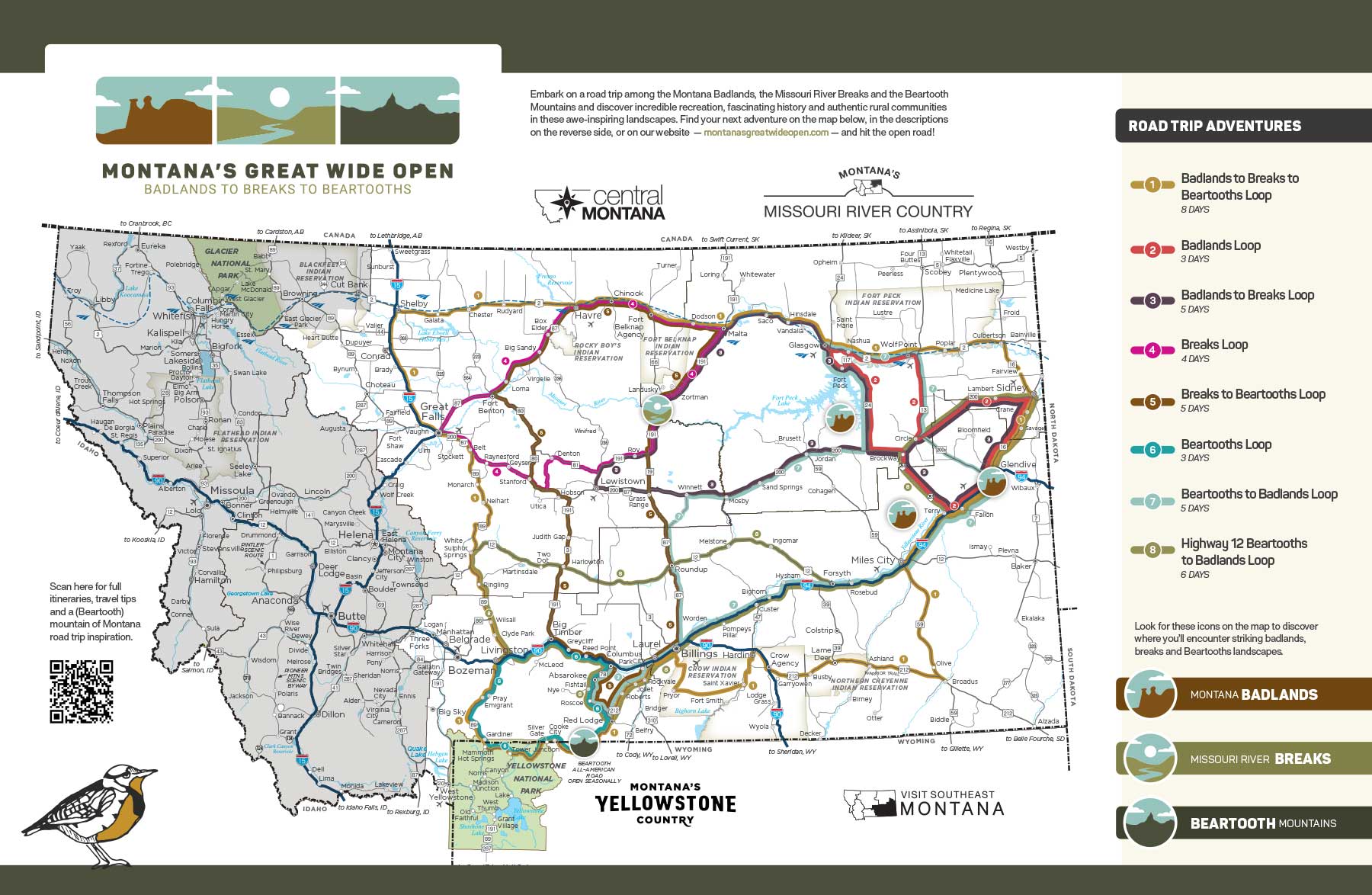
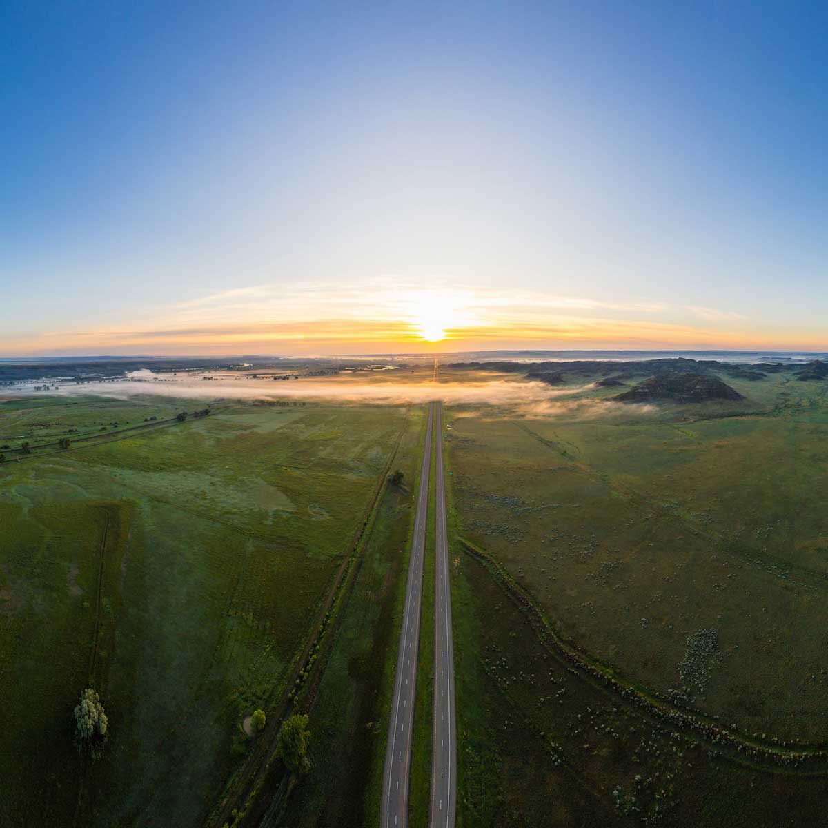
Big Sky Country? Try Big Drive Country! For those road trippers seeking an unforgettable travel experience as expansive as the skies over Montana, this grand tour is for you. Over the course of eight days, this route takes you from the mesmerizing badlands of Southeast Montana to the majestic river breaks terrain along the Missouri River at Fort Peck through the wide-open plains on north-central Montana’s Hi-Line and down to the mighty Beartooth Mountains near Yellowstone National Park. Along the way, discover the towns big and small, the museums and historical sites, and the parks, refuges and recreational places where the history, heritage and character of these far-reaching landscapes come to brilliant life.
 Andy Austin
 Rick & Susie Graetz
 Jordan Lefler
 Jordan Lefler
Set your road trip in motion in Miles City. This community’s roots as a horse trading and livestock center are alive and well today — cattle auctions take place weekly and the renowned Bucking Horse Sale, a major rodeo stock auction, lights up the town annually. Visit the Range Riders Museum to explore 38,000 square feet of exhibits — some of them in historic structures — highlighting the area’s dinosaur, Native American and, later, military and pioneer history. Near the spot where the Tongue River meets the Yellowstone in town, check out WaterWorks Art Museum, housed in the 1910 waterworks facility that produced the city’s drinking water into the 1970s. In addition to showing regional and national exhibits, the museum displays pieces from its permanent collection, which includes vintage photographs from acclaimed photographers who documented the West at the turn of the 20th century. And not too far fromWaterWorks, you can get on the river to float the Lower Yellowstone River Trail. Try a burger at one of the four Southeast Montana Burger Trail stops here — June’s Bungalow, Tilt Würks Brewhouse, Tubb’s Pub and Vintage & Rustics in Montana — before making a side trip to Strawberry Hill Recreation Area, just a 15-minute drive away. Hike through native grasses, sagebrush and ponderosa pines and on rugged rock formations to catch the view of the Yellowstone Valley at this 4,000-acre area. Spot wildlife here or, at night, a sky full of stars — Strawberry Hill is a site on Montana’s Trail to the Stars.
From Miles City, head east on Interstate 94 through the Yellowstone River valley to Terry, the county seat of Prairie County. In Terry, stop at Prairie Unique, a shop — and unofficial visitor center — where you’ll find a wealth of Made in Montana goods, like gourmet treats, skin care items and gifts crafted from antlers. The kindly owners are a friendly source of local knowledge to boot. For an intimate perspective on turn-of-the-20th-century life in Terry and its surroundings, check out the photographs of Evelyn Cameron; you’ll find them at the Prairie County Museum and Evelyn Cameron Gallery and across the street at the Evelyn Cameron Heritage. Another spot to take in some Terry history is the Kempton Hotel, the oldest continuously operated hotel in Montana. Built by homesteaders and opened for business in 1902, it has hosted the likes of Theodore Roosevelt and Calamity Jane, and continues to welcome travelers to stay in updated rooms that still retain historic charm. For its part, Roy Rodgers Bar Grill & Casino in town welcomes burger enthusiasts as another Southeast Montana Burger Trail stop.
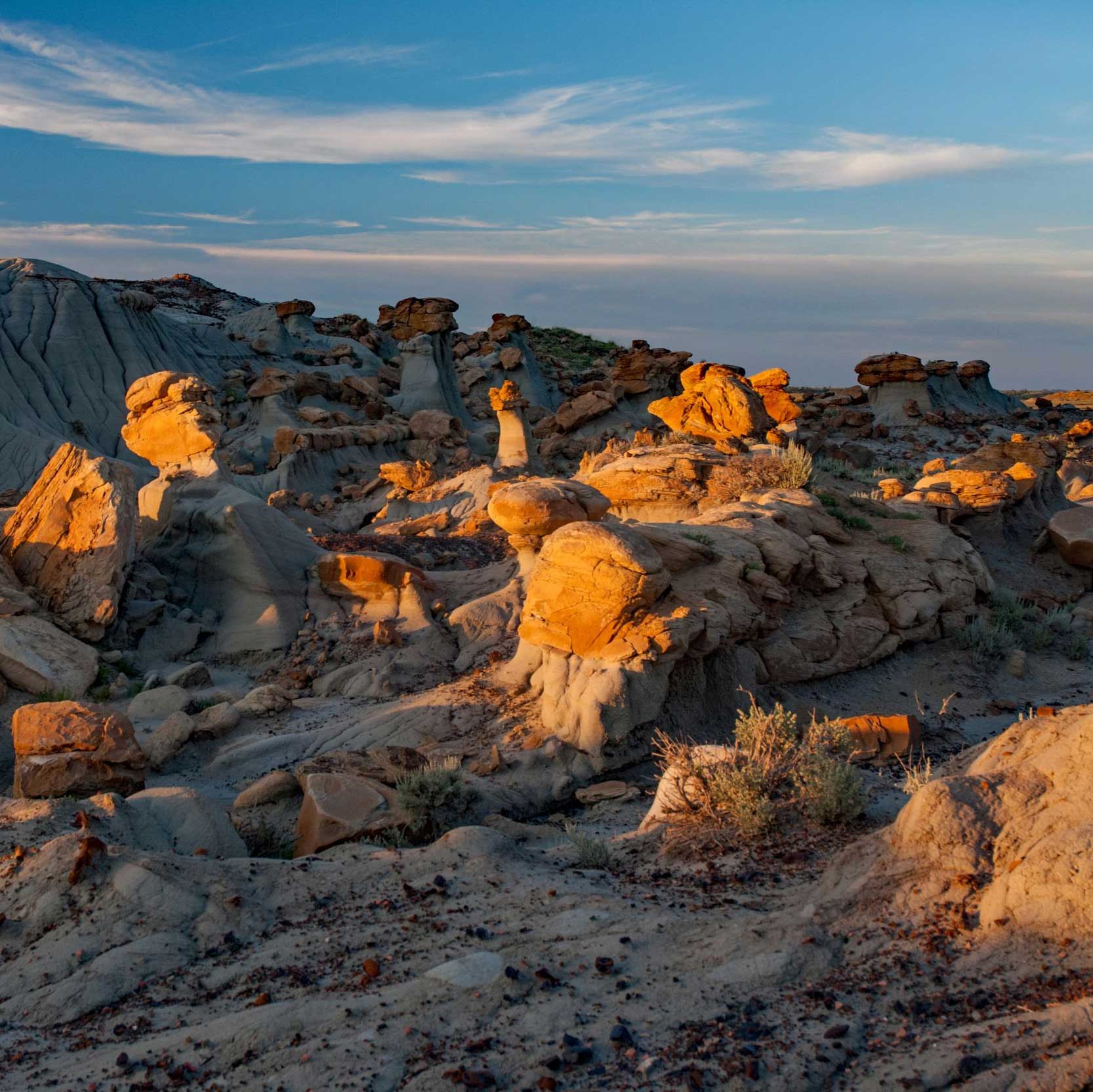
After your explorations in town, head to the Terry Badlands — a Bureau of Land Management Wilderness Study Area (WSA) — for your first breathtaking dose of badlands terrain and opportunities for rock collecting and backcountry hunting. Reach a stunning scenic overlook via State Secondary Highway 253 north of Terry for views that are spectacular both during the day and at night — the area’s dark skies make the Terry Badlands Overlook a phenomenal site for stargazing, earning it a place on Montana’s Trail to the Stars. You can also head west from Terry on Old Highway 10 (the frontage road) to access the Terry Badlands via the Calypso Trail, which delivers a panoramic view of rugged, untouched prairie that looks much like it would have more than a century ago. From the Calypso Trail you can access the Natural Bridges Trail, a short, moderate hike to hoodoos and natural bridge formations. Note that you should visit the rough WSA terrain only when the road is dry and in a high-clearance, four-wheel-drive vehicle.
There’s also great fishing to be had on the Yellowstone River near Terry (for the likes of paddlefish, perch and walleye), so if you’re inclined, head to the fishing access site in Fallon, about 9 miles east of Terry on I-94. In addition to fishing, it’s a perfect spot to hunt for Montana moss agates, which are only found on the banks of the Yellowstone.
Continue east on I-94 to Glendive, the hub city of agricultural eastern Montana, as sweeping prairie landscape gives way to more and more badlands terrain. The Tyrannosaurus rex sculpture on the “Welcome to Glendive” sign is an appropriate greeter for an area that developed on the late-Cretaceous Hell Creek Formation and has been a hotbed of significant fossil finds for more than a century. In town, visit the Frontier Gateway Museum — a stop on the Montana Dinosaur Trail and a Talking Trail site — to see a collection of dinosaur fossils as well as a full-size skeleton cast of a Struthiomimus named Margie for the “finder” who discovered it nearby. (The museum showcases more recent history too, featuring Native American and homestead-era artifacts and historic structures from the area). At the Glendive Dinosaur & Fossil Museum, view more than 23 full-size dinosaur and fossil exhibits, including an 18-foot-tall T. rex, a 39-foot-long Acrocanthosaurus and a 40-foot-long Tylosaurus, presented in the context of biblical history. If you’ve worked up an appetite after your museum visits, you’re in luck: Glendive is home to American Legion Post 28, whose Legionnaire burger earned it a spot on the Southeast Montana Burger Trail.
On the southeastern outskirts of Glendive, explore Makoshika State Park and its remarkable badlands formations — “Makoshika” (pronounced muh-KOH-shih-kuh) is a variant spelling of a Lakota phrase that translates to “bad land” or “bad earth.” A variety of hiking trails wind through the striking landscape, where wind and water erosion have sculpted caprocks, natural bridges, pinnacles, pedestals and fluted hillsides and helped to reveal dinosaur remains — the park is a site on the Montana Dinosaur Trail. Ten dinosaur species have been discovered at Makoshika, including T. rex, Edmontosaurus and the rare Thescelosaurus. You can see partially uncovered hadrosaur vertebrae in a hillside on the 1.5-mile Diane Gabriel loop trail, and the park’s visitor center features a triceratops skull in addition to other dinosaur remains and badlands interpretive displays. Makoshika State Park is Montana’s largest state park, and offers lots of activities beyond hiking and dinosaurs. Visitors will find scenic drives, a disc golf course, an archery range, a picnic area and campgrounds; some trails can be used for biking and horseback riding. The park is also a site on Montana’s Trail to the Stars — it’s a breathtaking place for stargazing.
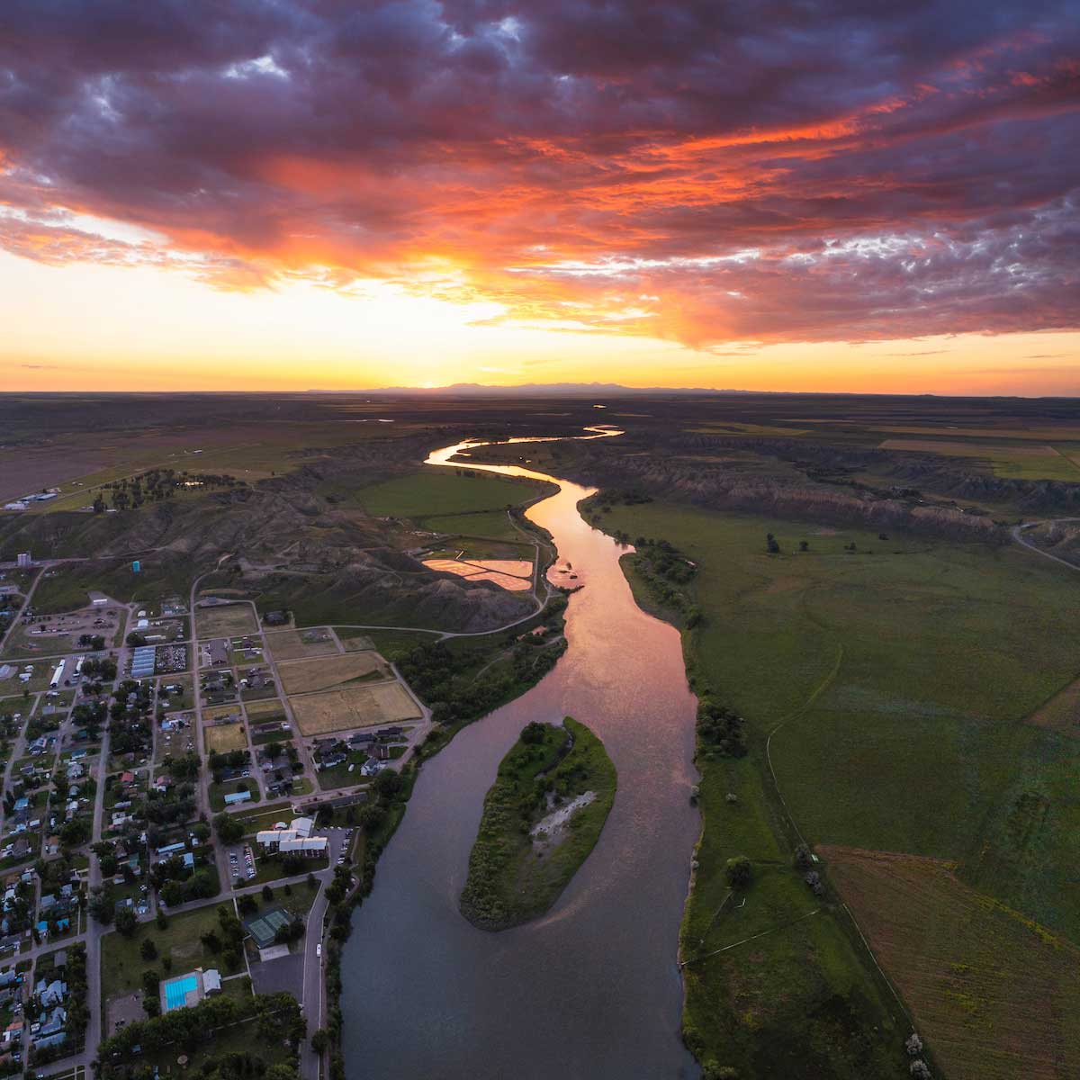
From Glendive, head north on Montana Highway 16 to reach Sidney, an agricultural community on the banks of the Yellowstone River. The town, with views of bluffs, badlands and red-capped hills, is a convenient jumping-off point for the area’s plentiful hunting and fishing opportunities. Take a walk into the past at Sidney’s MonDak Heritage Center, an art and local history museum — and Talking Point on the Missouri River Country Talking Trail — that features artifacts from dinosaur bones to a 1906 Model N Ford, as well as an extensive early 1900s street scene complete with boardwalks. Follow the Yellowstone River north to where it meets the Missouri River, and at the confluence you’ll find Fairview, the easternmost town in Montana. In fact, the community is so far east it’s actually split between Montana and neighboring North Dakota — Interstate Street in town runs on the state line, so people on opposite sides of the street are standing in two different states. Take a little jaunt into North Dakota to see the Fairview Bridge and Cartwright Tunnel, points on the Talking Trail and relics from the days of the Great Northern Railroad’s plan for its Montana Eastern Railway that have since been developed into a walking trail.
Take MT-16 north from Sidney, and at its intersection with U.S. Highway 2 you’ll find the community of Culbertson. One of the oldest towns in eastern Montana, it was founded in 1887, first centered on horse trading and ranching then cattle ranching and homesteading. Today Culbertson is an agricultural, livestock and oil production town, but you can explore its history at the Culbertson Museum and Visitor Center, a Talking Point on the Missouri River Country Talking Trail that features artifacts and historical photos as well as rooms designed to look like places from the community’s early days, like a country church, one-room school and general store.
From Culbertson, you’ll start the drive west on US-2, the northernmost east-west road crossing Montana. This stretch of highway, together with the rail line it parallels and the towns and landscape along them, is known by locals as the Hi-Line. You’ll soon enter the Fort Peck Reservation, home to members of the Assiniboine and Sioux Tribes, and farther along the road, you’ll reach Wolf Point, once a trading post and now the reservation’s cultural center and most populous town. Visit the Wolf Point Area Historical Society Museum — if you’re traveling on a summer weekday — to see artifacts of the area’s Native American cultures as well as antiques and heirlooms from settlers who arrived starting in the late 1800s. The museum — a spot on the Missouri River Country Talking Trail — also features a life-size statue of famed Montana artist Charles M. Russell made by a Wolf Point local.
Stay on the Hi-Line heading west and turn south on Montana Highway 117 in Nashua to make your way to Fort Peck and its rich mix of cultural and historical sights and recreational opportunities — many of which are Missouri River Country Talking Trail Talking Points. Make the Fort Peck Interpretive Center your first stop to explore exhibits on the history of Fort Peck Dam — the largest hydraulically filled dam in the U.S. — and on the area’s natural history and wildlife. That includes dinosaurs: The center, a Montana Dinosaur Trail site, is home to both a life-size model and a skeleton cast of Peck’s Rex, a T. rex found just 20 miles away, as well as other dinosaur fossils. A wildlife exhibit and two freshwater aquariums — the largest in Montana — highlight the land animals and fish found on the Charles M. Russell National Wildlife Refuge and in Fort Peck Lake and the Missouri River. Next, head to the beautiful Fort Peck Summer Theatre, a true gem of Northeast Montana and the state as a whole. Built as a movie house in 1934, its sound construction and craftsmanship — and the tireless preservation efforts of the Fort Peck Fine Arts Council — mean that it still stands today and hosts a summer series of stage productions.
Outdoor recreation here centers around Fort Peck Lake, which is completely bordered by the 1.1 million-acre Charles M. Russell National Wildlife Refuge, the second-largest national wildlife refuge in the lower 48. The reservoir — created by Fort Peck Dam — is Montana’s largest body of water, with a length of 134 miles and more shoreline than the coast of California. Six recreation areas, including the Fort Peck Lake Reservoir and Recreation Area, can be found around the lake and offer excellent swimming, camping, hunting, boating and year-round fishing — walleye, northern pike, paddlefish, sauger and lake trout are just a few of the species that will keep anglers busy. The tucked-away Pines Recreation Area rewards intrepid travelers who navigate the dirt road to get there with serene scenery, great photo opportunities and, if you decide to camp, incredible stargazing — it’s a stop on Montana’s Trail to the Stars.
Before you depart the Fort Peck area for destinations west, don’t miss the chance for some incredible views of stunning breaks terrain — higher country that “breaks” into steep slopes, canyons and ravines where it meets the river. On the Fort Peck side of the Missouri, check out the Lewis and Clark Overlook, complete with interpretive signage and a picnic area. After crossing the Missouri River on Montana Highway 24, take the short detour to the Milk River Observation Point — one of the highest spots in northeast Montana and the place where Lewis and Clark stopped in 1805 and observed the confluence of the Missouri and Milk rivers — and take in the awesome sight of the rivers and of Fort Peck and the lake spread out below. You can find out more about each of these two vantage points on the Missouri River Country Talking Trail app.
From Fort Peck, it’s just a short jaunt to the northwest on MT-24 to reach neighboring Glasgow, a rural community with railroad roots. You can learn more about Glasgow’s railroad past — along with the Indian cultures that have historically called this area home, early 20th-century homestead and cowboy life, Montana military history and Fort Peck Dam construction — through the eclectic exhibits at the Valley County Pioneer Museum. The museum also features a collection of more than 200 wildlife mounts. And speaking of wildlife, visitors to the Children’s Museum of Northeast Montana and its hands-on arts and science exhibits can explore the taxidermy collection of animals from around the world in the museum’s World Wildlife Experience. You can learn more about both museums and the World Wildlife Experience on the Missouri River Country Talking Trail app.
If experiencing wildlife in its natural surroundings is more your thing, head northwest of Glasgow to the Bitter Creek Wilderness Study Area — another Talking Trail site and a prime place for wildlife watching and hunting. And farther west along the Hi-Line, Malta offers exceptional access to wildlife-centric recreation — even Lewis and Clark commented upon the abundance of animals here when they traveled through the area in 1805. Close by are the Charles M. Russell National Wildlife Refuge and the Bowdoin National Wildlife Refuge — a Missouri River Country Talking Trail Talking Point — both of which provide chances for deer, antelope, elk and upland game bird viewing and hunting in pristine wilderness. Fishermen will find opportunities to catch walleye, paddlefish, trout and other species at the nearby Milk River, Nelson Reservoir — another Talking Point on the Missouri River Country Talking Trail — and even local ponds.
Interested in wildlife of the prehistoric variety? Malta has you covered there, too. The town boasts two museums that are stops on the Montana Dinosaur Trail and the Missouri River Country Talking Trail: the Great Plains Dinosaur Museum and Field Station and the Phillips County Museum. The Great Plains Dinosaur Museum features a wealth of fossils, from plants, turtles and crocodiles to Jurassic and Cretaceous dinosaurs including triceratops, stegosaurus and the horned Maltaceratops. A real treasure here is “Leonardo,” a mummified duck-bill Brachylophosaurus canadensis so well-preserved that fossilized skin covers the body. At the Phillips County Museum, see a 33-foot-long, 95% complete Brachylophosaurus along with other dinosaur fossils and get a sense of Malta’s more recent history through exhibits on Native Americans, cowboys and outlaws, and pioneer life and through the historic H.G. Robinson House — a mail-order home that was originally constructed on the prairie in 1898 and now sits on museum grounds.
An hour’s drive west on US-2, through northern reaches of Fort Belknap Reservation and loosely parallelling the Milk River through an open plains landscape, will bring you to the small agricultural community of Chinook. On the 500 block of Chinook’s historic main street, visitors will find Blaine County Museum. The museum, a Montana Dinosaur Trail stop, features hadrosaur, gorgosaurus, and edmontonia fossils from the Judith River Formation as well as remains of gigantic marine reptiles — mosasaur and plesiosaur — and invertebrates from the area, once covered by an ancient ocean. Other museum exhibits feature historical, early twentieth-century photographs of the Aaniiih (Gros Ventre) and Nakoda (Assiniboine) people of Fort Belknap, and artifacts from the early days of local ranching and homesteading. Chinook was once the stomping grounds of Montana’s famed cowboy artist Charles Marion Russell, and Blaine County Museum boasts a small display of CMR originals. The museum is a partner of the National Park Service and distributes NPS trail guides and other literature related to Bear Paw Battlefield — the site where the harrowing Nez Perce Flight of 1877 came to its dramatic close. On Oct. 5, following a five-day battle with elements of the U.S. Army led by Col. Nelson A. Miles, Chief Joseph delivered his immortal surrender, “From where the sun now stands, I will fight no more forever.” Museum visitors will find exhibits displaying artifacts found at the battle site and time-period photographs, as well as the 20-minute documentary "Forty Miles from Freedom." Bear Paw Battlefield itself is located 16 miles south of Chinook.
A block from Blaine County Museum, visitors can experience Blaine County Wildlife Museum. Arguably one of Montana’s greatest hidden gems, the museum features world-class wildlife displays, spotlighting native species in painstakingly detailed representations of their natural habitats.
After a short, 30-minute drive on the Hi-Line from Chinook, you’ll arrive in Havre, a rural agricultural community and railroad town that sits near both the Rocky Boy’s Indian Reservation and Fort Belknap Indian Reservation in a landscape of wheat fields and prairie, with the Milk River to the north, and the Bears Paw Mountains to the south. On the northern slopes of these peaks, you’ll find 10,000-acre Beaver Creek Park, the largest county-owned park in the nation, and its abundant recreational opportunities: camping, fishing, hiking and bird watching in summer, ice fishing, skiing, snowshoeing and sledding come winter and epic stargazing all year round — the park is a Trail to the Stars site. And speaking of winter, Bear Paw Ski Bowl, nestled in the heart of the Bears Paw Mountains, is a little-known but beloved ski hill that is a favorite spot for locals to ski both downhill and cross-country.
Havre’s roots lie in the establishment of Fort Assiniboine in 1879: Traders were drawn to the fort, soon leading to formation of a small town that grew — particularly after 1890, when the Great Northern Railroad arrived — into Havre. Today you can tour Historic Fort Assinniboine, which was one of the largest forts built in the U.S. and constructed expressly to protect against attacks from Native American tribes living in the region, particularly the Sioux Indians. Of the forts in Montana, it has the most original buildings still standing. In town, explore the Havre of yesterday at Havre Beneath the Streets, a tour of the underground spaces that housed various Havre businesses — a honky-tonk, opium den, restaurant and bordello among them — while the community was rebuilt following a city-wide fire.
There are opportunities to explore area history that reaches back further than the 1800s, too. In addition to more recent area history, the H. Earl Clack Memorial Museum — a Montana Dinosaur Trail site — features an exhibit of 75-million-year-old dinosaur eggs and embryos found nearby in the Judith River Formation as well as a cast of a skull from the rare Stygimoloch. The museum also manages the Wahkpa Chu’gn Buffalo Jump (pronounced WALK-paw CHEW-gun) — a true archaeological treasure. Used extensively by Native Americans over the last 2,000 years as a kill site as well as a campsite, the buffalo jump features exceptionally well preserved faunal layers that extend up to 20 feet below the surface and has been excavated in such a way as to leave artifacts exposed in the exact places they were left.
Set out from Havre on the Hi-Line and enjoy vistas of wheat fields stretching endlessly under a huge sky as you make your way west. Stop in Rudyard — don’t miss their community sign that reads: Rudyard, Home to 596 People and One Old Sore Head! — and into its Depot Museum (a Montana Dinosaur Trail stop) to visit the fossilized skeleton of a Gryposaurus discovered nearby. Continue west on US-2 to Chester, a Hi-Line hub of recreational opportunities. Explore the Sweet Grass Hills — they’re actually low mountains — that rise above the plains to the north or head southwest from town to Lake Elwell, a reservoir created by the construction of the Tiber Dam on the Marias River. Boating, swimming, water skiing, camping and birdwatching are popular pastimes on the lake, as is year-round fishing for the likes of walleye, pike, native trout and perch. The lands surrounding Chester make great hunting ground for deer, antelope, upland game birds and waterfowl.
Continue your Hi-Line drive west through about 44 miles of rolling plains to the junction of US-2 and Interstate 15, where you’ll find the community of Shelby. Once a cattle town, Shelby today is a center for agriculture and oil production. Get to know this north central Montana town at the Marias Museum of History and Art, which spotlights homesteading history and Shelby’s sports history claim to fame as the site of the 1923 World Heavyweight Boxing Championship between legend Jack Dempsey and Tommy Gibbons. Another Shelby highlight is the restored 1936 carousel — complete with 900 lights and hand-painted animals — housed in the rest area near I-15. It makes for a pit stop to remember!
From Shelby, it’s about an hour and a half drive south through expansive prairie land to Great Falls, which straddles the Missouri and gets its name from the series of five waterfalls marking the river’s descent from the Rocky Mountains to the level of the plains. Get an up-close look at the Great Falls waterfall at Giant Springs State Park, which features one of the world’s largest cold water springs, a trout hatchery and paved and single-track trails — it’s a beautiful place to fish, hunt, hike, bike, bird watch or just spend relaxing time outdoors. At the Lewis and Clark National Historic Trail Interpretive Center, situated on the river next to the park, learn some of the early history of the region, including how the Corps of Discovery portaged the five falls over the course of a month in 1805 — the exhibit hall features a two-story diorama of the feat. A short distance west of town at First Peoples Buffalo Jump State Park, explore the archaeological site believed to be the largest buffalo jump in North America. Native peoples used the site — a mile-long sandstone cliff — for at least 2,000 years and the park’s interpretive trail and on-site education center help visitors to understand the history of this high plains hunting method and the people who practiced it.
Make your way south via the Kings Hill Scenic Byway, which stretches from the junction of U.S. Highway 87 and U.S. Highway 89 east of Great Falls to the junction of US-89 and U.S. Highway 12 just north of White Sulphur Springs. This road winds through the heart of the Little Belt Mountains, delivering breathtaking views of spectacular peaks and pristine lakes and streams as it leads you to the doorstep of White Sulphur Springs, named after the hot springs that have drawn people to its reinvigorating mineral waters for centuries. This quaint Central Montana community sits in the Smith River Valley within the Lewis and Clark National Forest, nestled among mountains — the Little Belts to the north, the Big Belt Mountains to the west and the Castle Mountains to the southeast. It’s no wonder, then, that opportunities for hiking, camping, wildlife watching, fishing and hunting abound here. White Sulphur Springs is an ideal start or end point for multi-day floats on the Smith River — a coveted Montana experience as the required permits are awarded by advance lottery and are quite limited. And in winter, Showdown Ski Area offers lots of snow, great skiing and no crowds. In town, enjoy a hot springs soak — when in Rome! — at Spa Hot Springs Motel or visit the Meagher County Museum. Better known as the Castle Museum, this local history museum occupies a restored Victorian home and features period furniture, mineral samples and artifacts from the area’s past.
From White Sulphur Springs, head south on US-89, the two-lane road that will take you into the orbit of the Beartooth Mountains. The scenery of the Smith River Valley will meld into the landscape of the stunning Shields Valley as you make your way south. Here, the mountains in the distance are the Bridgers (to the west) and the Crazy Mountains to the east. Stop at the Wilsall General Store in the little town of Wilsall to stretch your legs and peruse their selection of Made in Montana goods and Western accessories, or get out of the car for a fresh-air stroll — and perhaps a bite or a cold beverage — in Clyde Park.
When you get to Interstate 90, head west to Livingston. Long a hub for artists, writers and outdoor enthusiasts, Livingston offers plentiful opportunities to experience arts and culture, history, and incredible outdoor recreation. Its downtown, with several “Old West” buildings that date to the 1880s and ’90s, serves as the charming backdrop for a noteworthy restaurant and bar scene. Livingston marks the start of your drive on US-89 through the stunning Paradise Valley. Heading south, the road follows the Yellowstone River, with the Gallatin Mountains to the west and the Absaroka-Beartooth Wilderness to the east, and runs into the town of Gardiner at the valley’s south end. Gardiner is the original entrance to Yellowstone National Park and the only entrance open to personal vehicle traffic year-round, making it a welcoming base camp for park visitors. The historic Roosevelt Arch marks the entrance to the park, and within sight of it is the Yellowstone Heritage and Research Center, a storage and research facility that houses a world of Yellowstone National Park treasures, including photographs, oral histories, watercolor field sketches by artist Thomas Moran and indigenous artifacts discovered in the park, among many other items. The center is part archive, part library and part museum, and visitors can see rotating exhibits from its holdings in the lobby or make an appointment to explore the archives or museum collections. Work at the center is supported in part by the Yellowstone Forever Institute, the official nonprofit partner of Yellowstone National Park dedicated to protecting, preserving and enhancing the park through education and philanthropy. It offers a variety of guided educational experiences of the park year-round that focus on wildlife, geology and cultural heritage.
Pass through the landmark Roosevelt Arch and enter Yellowstone National Park, turning east onto Grand Loop Road near the Mammoth Hot Springs area. As it crosses the northern part of the park, Grand Loop Road will become U.S. Highway 212 and will take you through the wildlife-rich Lamar Valley — depending on the time of year, keep your eyes peeled for bears, bison or wolves. You’ll exit the park a mile from Silver Gate, whose sister city, Cooke City, is a mere 3 miles farther east. Here, take a spin through the Cooke City Montana Museum’s exhibits on life in these remote communities over the years.
After your Silver Gate and Cooke City exploration, head east on US-212 to drive the iconic Beartooth Highway (open seasonally Memorial Day weekend-mid-October, as weather permits). Buckle up: The stretch connecting Red Lodge and Cooke City is the ride of a lifetime. A National Scenic Byway and All-American Road that’s been called “the most beautiful drive in America,” the Beartooth Highway delivers jaw-dropping views as switchbacks lead you up and up to Beartooth Pass at an elevation of nearly 11,000 feet. The 68-mile drive takes at least a couple of hours, more if you hike to an alpine lake from one of the trailheads along the way or if you stop at the numerous scenic pullouts to admire the incredible vistas — which is highly recommended.
The Beartooth Highway ends in Red Lodge, a mountain town that boasts stellar skiing opportunities in winter and makes a great basecamp for outdoor adventures in summer. Get a feel for the community with a stroll down its charming main street, then check out a couple attractions right in town: Carbon County Historical Society and Museum and the Yellowstone Wildlife Sanctuary. At the museum, you’ll find exhibits on many aspects of local history — including the Crow Nation, historic firearms and two families of rodeo fame — and at the sanctuary, see wildlife from the Greater Yellowstone Ecosystem up close, including bears, bison, bobcats, wolves, and birds of prey. Be sure to see the historic Pollard Hotel, which was the first brick structure in town when it was built in 1893. It’s hosted its share of famous guests over the years and continues to extend warm hospitality to travelers drawn to the Beartooth Mountains today. And speaking of hospitality, Red Lodge Ales’ taproom welcomes visitors looking to try locally crafted brews — and they won’t let you go hungry, thanks to their menu of pub fare. If a more elevated dining experience is what you’re craving, look no further than the James Beard Award-nominated PREROGATIvE Kitchen on Broadway. In summer, consider making a side trip on State Secondary Highway 308 to the Bear Creek Saloon and Steakhouse in Bearcreek for a bite and a brew — and the little known but much loved Bear Creek Downs Pig Races. Enjoy the lively race atmosphere and join in the fun by placing bets on which little piggie will be the fastest — some of the money goes to scholarships for Carbon County high school students. Past Bearcreek, S-308 leads to the community of Belfry and the turnoff to reach the town of Bridger.
You’ll take US-212 from Red Lodge to I-90, a stretch with rural Montana treasures awaiting your discovery. With the Beartooths at your back, pick up the road in Roberts to Cooney State Park. This gem of a park offers great boating, swimming and camping, incredible fishing for walleye and rainbow trout, and out-of-this-world stargazing. A little farther along the road, the town of Joliet makes a picturesque place for a pit stop, thanks to its numerous historic residences and buildings. Keep an eye out for the metal sculptures by local artist Charlie Ringer visible from the road: “The Creature” is an 18-foot-tall favorite that skiers and snowboarders heading to Red Lodge have dubbed “The Snow God.”
US-212 intersects with I-90 in Laurel, where several markers on Main Street detail some of the history of the area, including a stop by Capt. William Clark during his travels in the West, the passage of the Nez Perce Indians during their flight to Canada (and the battle they fought against the U.S. Cavalry north of town) and the arrival of the railroad. If you’re following the Southeast Montana Burger Trail, check out Sid’s East Side Bar & Grill, which earned a spot on the trail with its delicious Doc Holliday burger.
After a short drive on I-90, arrive in Billings, where there’s much to explore in and around town, thanks to its vibrant downtown, museums, historical sites and opportunities for outdoor recreation. Visit the Yellowstone County Museum, the Moss Mansion Museum or the Western Heritage Center to familiarize yourself with the history and the inhabitants of the landscapes you’ll see in the days ahead. Time it right and catch one of the Western Heritage Center’s Hoof It with a Historian walking tours of historic Billings locations — you may encounter the Northern Hotel, a fixture of downtown Billings since 1904. Its current building — constructed in the early 1940s after its original structure was destroyed in a fire — was thoroughly renovated and updated in 2013. East of Billings, experience turn-of-the-20th-century farm life at the Huntley Project Museum, which tells the story of an innovative U.S. Army Corps of Engineers project to bring water to the dry farmlands of eastern Montana and the towns and homesteads it created through artifacts, farm equipment and historic structures on its 10-acre campus.
If Montana inhabitants of the furred and feathered variety are more your speed, head to ZooMontana, where you’ll see bison, grizzly bears, grey wolves, bald eagles and red-tailed hawks as well as some other species from the 45th parallel. At the Yellowstone Art Museum, let historic and contemporary artwork primarily by artists in the American Northwest inspire you, or take your own tour of the public art found throughout downtown. Take in the impressive overlook views of Billings and the scenery beyond from Swords Park, Zimmerman Park and the 3-mile-long, multi-use Skyline Trail that connects them along the Rimrocks — or “Rims” as they’re locally known. These sandstone outcroppings, the prehistoric river's edge, form a distinctive feature from which you can see the entire city, including six mountain ranges on a clear day. Nearby, Four Dances Natural Area just outside of town affords wildlife watching and hiking opportunities along the way to Pictograph Cave State Park, where you can view rock paintings and artifacts left behind by prehistoric hunters 2,000 years ago.
If you’ve worked up an appetite after your full day of exploration, check out one — or all three (we know a person on a mission when we see one) — of Billings’ Southeast Montana Burger Trail stops: Diamond X Beer Co., The Burger Dive or Stacked | A Montana Grill. You’ll find two more fun ways to explore Billings and its food and drink offerings in Trailhead Treats and the Billings Brew Trail — trails that lead to establishments in town that will satisfy any sweet tooth or craft beverage craving.
Head south out of Billings on State Secondary Highway 416. As the road bends to the east, you’ll enter the Crow Indian Reservation, the largest of the seven reservations in Montana. When S-416 intersects with Pryor Road/State Secondary Highway 418, head south to reach the town of Pryor. Here, at the base of the Pryor Mountains, sits Chief Plenty Coups State Park, a 195-acre park that preserves the site of the log home and store of Chief Plenty Coups, the last chief of the Crow Indian Tribe. Explore Plenty Coups’ legacy as a bridge between two cultures at the on-site visitor center and on the grounds, which include a ¾-mile trail around the park.
From Pryor, head east on Montana Highway 91 across the reservation, climbing rugged plateaus before descending into the Bighorn River valley and reaching St. Xavier, where you’ll take State Secondary Highway 313 south. The road will follow the Bighorn River through rolling plains all the way to Fort Smith and the Bighorn Canyon National Recreation Area and its seasonal visitor center. Fort Smith was established to protect immigrants traveling on the Bozeman Trail from attacks by the Sioux Indians. Today, it’s a small recreation base camp community that sits below the Yellowtail Dam, a massive concrete arch dam built in the 1960s to provide flood control, irrigation for semi-arid land, power generation and recreation. Check out the Yellowtail Dam Visitor Center (open seasonally) to see short films and exhibits about the natural and cultural history of the region as well as the history of the dam itself and then take some time to experience the river. Above Yellowtail Dam find Bighorn Lake, known locally as “Yellowtail,” that sits beneath 1,000-foot-high towering cliffs. Explore the 71-mile-long reservoir by pontoon — you can rent them seasonally at the Crow Tribe-operated Ok-A-Beh Marina. Just below the Yellowtail Dam, Afterbay Lake is a good spot for wildlife viewing for ducks, geese and other animals, and the Bighorn River below the Afterbay Dam and Campground (downriver from Yellowtail Dam) offers world-class trout fishing.
Backtrack on S-313, and at St. Xavier, continue north to make your way to Hardin, a farming, ranching and surface coal-mining town on the northern edge of the Crow Indian Reservation. The community embraces the region’s history: It annually hosts a reenactment of Custer’s Last Stand that draws more than 200 participants, and the Big Horn County Historical Museum is the largest historical museum campus in the state, featuring exhibits and historic structures that tell the stories of Big Horn County.
Perhaps the most significant story associated with Big Horn County is that of the Battle of Little Bighorn, the 1876 clash between Sioux and Northern Cheyenne warriors led by Sitting Bull and the U.S. 7th Cavalry led by Lt. Gen. George A. Custer. The struggle marked one of the last armed efforts by indigenous peoples of the Northern Plains to preserve their way of life. To visit the site of the historic battle, take I-90 south from Hardin to US-212 — the Little Bighorn Battlefield National Monument sits just east of the junction. The monument features a visitor center and museum with exhibits on the history of the battle, Custer, weapons, archaeology and Plains Indian life; a ½-mile round-trip walking tour with interpretive signage; a 4.5-mile self-guided driving tour; and the Custer National Cemetery. To experience the site from the Native American perspective, consider a guided trip through Apsáalooke Tours — the company provides one- to two-hour interpretive tours of the battlefield with Native American guides on air-conditioned buses. Note that the Little Bighorn Battlefield National Monument will have limited visiting hours and access starting in spring 2024 as a new, state-of-the-art visitor center is built. On days when the monument is closed, the Big Horn County Historical Museum will be staffed with rangers who can answer visitors’ questions about the site. For the most up-to-date operating hours and information, see the website nps.gov/lib.
Leaving the monument, head east across plains that feel limitless on a stretch of US-212 known as the Warrior Trail. Before too long you’ll cross onto the Northern Cheyenne Indian Reservation, and in Busby, you’ll drive past the Chief Two Moons Monument, honoring the Northern Cheyenne chief Two Moons, who fought in the Battle of Little Bighorn. Farther along the road, you’ll come to Lame Deer, the tribal and government agency headquarters of the Northern Cheyenne Indian Reservation and the site of Chief Dull Knife College, whose cultural center features a diorama of the conflict at Little Bighorn and tribal docents that can answer questions and share the Northern Cheyenne perspective of the battle. Stop into the native women-owned Warrior Trail Jewelry and Gifts in town to find an array of indigenous-made and Montana-made products.
Just past the place where US-212 meets Montana Highway 59, stop in the farming and ranching community of Broadus for a visit to the Powder River Historical Museum, which celebrates Western heritage. Here you’ll find Native American artifacts, battlefield objects from the Reynolds Campaign (a precursor to the Battle of Little Bighorn) and collections, vehicles and structures representing homestead life on the plains. There’s also Mac’s Museum, a collection of minerals, arrowheads and more than 22,000 seashells gathered from around the world by one Powder River man over several decades.
From Broadus, take MT-59 north, the road gently rising, falling and winding through the plains. Keep an eye out for the community of Volborg, the home community of Professional Bull Riders World Champion Jess Lockwood, for a great place to stretch your legs and take an “Old West” selfie in front of the quaint General Store and Post Office. Then continue north on MT-59 all the way back to Miles City, closing the loop on your epic tour. It needn’t be the end of your explorations here, though. Check out our other itineraries that delve more deeply into each of the Badlands, Breaks and Beartooths regions. With the big-picture journey under your belt, you know better than anyone that in Montana’s great wide open, there’s always more to discover!

Great Wide Open road trips intersect with a handful of engaging Montana trails — the Montana Dinosaur Trail, Montana's Trail to the Stars, the innovative Talking Trail app and the Southeast Montana Burger Trail — and our itineraries note when a point of interest is a site on one of them. These trails enrich your travel experience in Montana, highlighting places where you can learn about dinosaurs, listen to stories of local history, nature and culture, find great spots for incredible stargazing or discover some truly remarkable burgers. Visit each trail's website to learn more.